






Title and statement of responsibility area
Title proper
General material designation
Graphic material
Parallel title
Other title information
Title statements of responsibility
Title notes
Level of description
Reference code
Edition area
Edition statement
Edition statement of responsibility
Class of material specific details area
Statement of scale (cartographic)
Statement of projection (cartographic)
Statement of coordinates (cartographic)
Statement of scale (architectural)
Issuing jurisdiction and denomination (philatelic)
Dates of creation area
Date(s)
-
1991 (Creation)
- Creator
- District of Coquitlam. Planning Department
-
1987 (Creation)
- Creator
- District of Coquitlam. Planning Department
-
1981 (Creation)
- Creator
- Pacific Survey Corporation
-
1975 (Creation)
- Creator
- Lockwood Survey Corporation Ltd.
-
1973 (Creation)
- Creator
- Lockwood Survey Corporation Ltd.
-
1963 - 1991 (Creation)
- Creator
- British Columbia. Dept. of Lands, Forests, and Water Resources
Physical description area
Physical description
1323 photographs : b&w and col. ; various dimensions
8 maps : various dimensions
1 cm of textual records
Publisher's series area
Title proper of publisher's series
Parallel titles of publisher's series
Other title information of publisher's series
Statement of responsibility relating to publisher's series
Numbering within publisher's series
Note on publisher's series
Archival description area
Name of creator
Administrative history
The Dept. of Lands, Forests and Water Resources was established in 1908 under its first name, the Dept. of Lands (Department of Lands Act, SBC 1908, c. 31). Before 1908 the agencies responsible for the functions of the Dept. of Lands, Forests and Water resources were: (1) the Dept. of Lands and Works (Crown lands management, sales, pre-emptions and leases, lands surveying and mapping, timber inspection, forest protection and log scaling), and (2) the Dept. of Mines (water rights in regards to mining operations). The Dept. of Lands, headed by the Chief Commissioner of Lands, was given responsibility for public lands and water rights, and all matters connected therewith. (SBC 1908, c. 31, s. 5). These responsibilities included: (1) the management of all public lands, as per the Land Act, (RSBC 1897, c. 113); (2) administration of water rights, as per the Water Clauses Consolidation Act, (RSBC 1897, c. 191) [in 1892 by means of the Water Privileges Act (SBC 1892, c. 47), the government had reserved to itself the right to manage all water resources in the province that were unreserved and un-appropriated as of April 23, 1892]; and (3) land settlement programs for returned soldiers. In 1909, the enactment of the Water Act (SBC 1909, c. 48) resulted in the creation of the Water Rights Branch of the Dept. of Lands, under the management of the Chief Water Commissioner (re-named Comptroller of Water Rights in 1912). This legislation also resulted in the creation of Water Districts under the management of District Engineers, who would be responsible for management in the field of the Branchs responsibilities. In 1911, the Timber Department, including Timber Inspectors, forest protection services and log scaling operations, was transferred from the Dept. of Public Works to the Dept. of Lands. In 1912, the management of timber resources was formally added to the departments responsibilities with the enactment of the Forest Act (SBC 1912, c. 17). To accommodate these new responsibilities, the Forest Branch, under the Chief Forester, was created in the Dept. of Lands. In 1945, the Dept. of Lands was renamed the Dept. of Lands and Forests (Department of Lands Act Amendment Act, SBC 1945, c. 45). At this time, the department was reorganized into two branches, the Lands Service and the Forests Service. In 1962, the Dept. of Lands and Forests was renamed the Dept. of Lands, Forests, and Water Resources (Department of Lands and Forests Act Amendment Act, SBC 1962, c. 22). At this time, the department was reorganized into three branches, the B.C. Lands Service, the B.C. Forest Service, and the B.C. Water Resources Service. On December 23, 1975, the Dept. of Lands, Forests and Water Resources ceased to exist. The government established two new agencies, the Dept. of Forests and the Dept. of Environment, to replace it (OIC 3838/75). All activities associated with the forestry function were transferred to the Dept. of Forests (OIC 3849/75, 3868/75). With one minor exception, the remaining functions of the Dept. of Lands, Forests, and Water Resources were transferred to the Dept. of Environment (OIC 3843/75, 3844/75, 3846/75, 3852/75). In 1976, these organizational changes were reiterated in legislation (SBC 1976, c. 18)
Name of creator
Administrative history
The Lockwood Survey Corporation Ltd. was an aerial photographic survey company based in the Toronto, Ontario area with divisions across Canada, the west coast division being located at 1409 West Pender Street, Vancouver, BC.
It was formed out of a number of amalgamations, mergers and name changes of predecessor companies, beginning with the Toronto-based Photographic Survey Company, which began in 1946 under the direction of Douglas M. Kendall, with British financing from Sir Percy Hunting. From 1956-1965, the company was known as Hunting Survey Corporation, Ltd., later known as Lockwood Survey Corporation, Ltd. from 1965-1972. From 1972-1975 the company was called Northway Survey Corporation, Ltd., and then Northway- Gestalt Corporation Ltd. from 1975-1984. The company has been named Northway Map Technology Ltd. since 1985.
Name of creator
Administrative history
Pacific Survey Corporation was a mapping firm based in Vancouver. Its operations ceased prior to 1989.
Name of creator
Administrative history
Custodial history
The photographs were purchased by the Planning and Development Department. The photographs were transferred to the Archives in 2016.
Scope and content
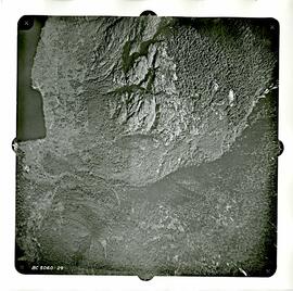
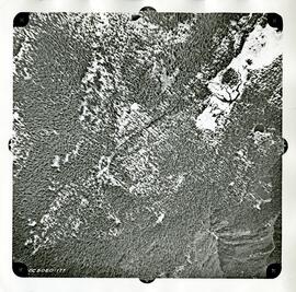
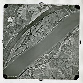
The series consists of aerial photographs taken by the Department of Lands, Forests, and Water Resources in 1963 and 1969.
Notes area
Physical condition
Arrangement
Language of material
Script of material
Location of originals
Availability of other formats
Restrictions on access
Terms governing use, reproduction, and publication
The aerials from 1963 and 1969 are Public Domain. The rest are under copyright and cannot be reproduced. An appointment can be made to view these materials.
Finding aids
Associated materials
Accruals
General note
The Series was originally S02 in the Corporation of the District of Coquitlam fonds (F41).